
Some five weeks after its launch from Vandenberg Air Force Base in California, GeoEye-1, the satellite developed by aerial and geospatial information provider GeoEye, has signaled back to Earth.
GeoEye-1 snapped the first location the satellite saw when the camera door was opened -- Kutztown University, located midway between Reading and Allentown, Penn. Viewed online, the image shows sharper detail than is typical of satellite work: The shot was collected at 0.41-meter ground resolution.
Academic buildings, parking lots, roads, athletic fields and the track-and-field facility were captured in the image. It was collected at 12:00 p.m. EDT on Oct. 7, 2008, while GeoEye-1 was moving north to south in a 423-mile-high orbit over the eastern seaboard, traveling 4.5 miles per second.
Not Just a Pretty Picture
Built by General Dynamics Advanced Information Systems with an imaging system provided by ITT, GeoEye-1 is part of the National Geospatial-Intelligence Agency's NextView program. Its purpose is to make sure the agency has access to commercial imagery. GeoEye won the US$500-million NextView contract in September 2004. The satellite camera it developed can distinguish objects on the Earth's surface as small as 0.41-meters, or 16 inches in size.However, due to licensing restrictions, commercial customers will get access to imagery at no less than half-meter ground resolution.
"These are mapping machines in orbit -- what they are producing is more than just a pretty image," Mark Brender, vice president of communications at GeoEye, told the E-Commerce Times. "Each pixel is associated with a latitude and longitude."
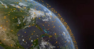
Commercial customers for these images include companies in the oil and gas, insurance, risk management, real estate and mining industries, as well as state and local governments and foreign governments and militaries, Brender said. Google is also a commercial client and will be using the sharper images in its Google Earth and Google Maps applications.
Next Month
GeoEye is in a 45-to-60-day engineering calibration period, Brender explained. Once that is complete -- likely in the first week of November -- it will begin to make the images commercially available.
Unless you are a paying customer, it is unlikely you will see all of the detail that these images provide. "The images are map-accurate," Brender explained. "A Google user can do a screen grab, but there is no way he or she can download the image with its embedded geospatial characteristics."
Even without these features, the new images are a big step up from what can be now found online, said Bob Lozano, principal of Appistry, which provides a next-generation geospatial intelligence application that's used by GeoEye in a cloud computing environment.
New Art Form
The launch of Google Maps and Google Earth popularized a new creative medium: mashup applications. For almost every plausible scenario -- a real estate agent mapping her houses, a girl scout troupe illustrating its territory -- it seems as though a Google Maps-inspired mashup has been developed.
Higher-grade imagery will inspire another wave of creativity, Lozano predicted. "Even without having all of the technical characteristics in the images sent for military applications, we can develop some fairly sophisticated uses for these shots."
A municipal government might use them to track construction activity within its boundaries -- or soil erosion or rainfall, which could be measured by studying the vegetation. At some point, Lazano said, such change-detection applications could be automated, so images of a certain area would be taken routinely for comparison.
"There is going to be a lot of excitement and energy around this," he predicted.


Here’s one… You’re on a vacation, having a good time, you don’t have a camera (they’re extinct), but just a click on the button of your moby (future cell phone) sends a GPS signal to the satellite, satellite aims its GeoEye on you and snaps a photo (or more), and sends it back to your moby, or any other location of your choice…
Messing around with bulky (or whatever) cameras and making photos you’re never on – is just plain old…